FAA Updates Datalink Weather Advisory Circular
iPad Pilot News
 The rollout of ADS-B datalink weather over twelve years ago was an interesting time for GA pilots. In a nutshell, the FAA flipped the switch on a new network of ADS-B ground stations in the early 2010s, started broadcasting subscription-free FIS-B weather products, and put it in the hands of the private sector to develop new hardware.
Fortunately, Appareo and ForeFlight teamed up to develop the first Stratus portable ADS-B receiver in 2012, and we’ve never looked back since. Pilots were free to use the system immediately with these new portable receivers, which improved in-flight decision-making almost overnight. The result was tangible, too, with weather-related fatal accidents steadily declining in the following years.
Eventually, the FAA’s Flight Technology group acknowledged the benefits of flying with datalink weather in the cockpit and released Advisory Circular 00-63A in 2014. This validated what GA pilots already knew about the benefits of flying with ADS-B In over the previous two years and provided some good tips for pilots new to the tech.
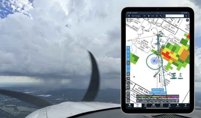
Since the system debuted, many changes have occurred. Portable receivers, like ForeFlight’s Sentry, are much more sophisticated, and new ADS-B weather products have been developed. On the advisory side, the FAA recently updated the related advisory circular on the topic: AC 00-63B – Use of Flight Deck Displays of Digital Weather and Aeronautical Information.
Key points in the AC
At nearly 52 pages in length, this AC is rather long and includes a lot of extraneous information and acronyms that can make it tough to pick out what actually matters here. With that in mind, we pulled out several key points that both existing pilots and those new to ADS-B should remember.
In the beginning, the AC sets a clear expectation for pilots in how they can use ADS-B datalink weather:
Pilots and operators may use AI (Aeronautical Information) and METI (Meteorological Information) data link services for preflight, as well as in-flight, updates to support operational decisions and assist in the safe conduct of flight.
Next, the AC recognizes the benefits that can be gained by flying with datalink weather:
Enhanced operational safety
Increased situation awareness
Better airline and GA economics
Better alternate planning
Reduced aircraft maintenance
Reduced pilot workload
In case you’re wondering about the “reduced aircraft maintenance” line, the AC suggests that the display of weather hazards will assist pilots in avoiding hazardous areas that might contain hail.
In addition to providing continuous in-flight weather updates, ADS-B provides updates to NOTAMs and TFRs in flight too. The AC recognizes the value of the graphical depiction of this data (over the legacy text format) in mobile apps and on approved avionics displays:
Graphical depiction in combination with text would in many cases make the information more intuitive and easier to interpret, such as with TFRs, thus increasing safety.
The AC also makes it clear that is perfectly acceptable to use an EFB for flight planning and preflight weather, in addition to providing weather updates while en route:
Flight planning via a data link service and using a portable or installed Electronic Flight Bag (EFB), whether on the ground or airborne, is an acceptable use of AI and METI data link services. Pilots that are comfortable with self-briefing, via FAA Flight Services, or an equivalent means, may use the EFB to display the METI and AI as well as to file flight plans.

Limitations of the datalink weather
The AC addresses the most important limitation of datalink weather, which is that it is not live or real-time data and that pilots should not use it for close navigation around hazardous weather if visual separation cannot be maintained:
Product Latency. Be aware of the product time or “valid until” time on the particular data link information displayed in the flight deck. For example, since initial processing and transmission of Next Generation Weather Radar (NEXRAD) data can take several minutes, pilots must assume that data link weather information will always be a minimum of 7 to 8 minutes older than shown on the time stamp. Thus, pilots should only use data link weather radar images for broad strategic avoidance of adverse weather.
Since ADS-B relies on a network of ground stations, pilots should be aware that you may not start receiving the datalink signal until several minutes after takeoff. The AC states limited coverage below 5,000′ AGL, but in our experience you should start getting reception within 1,000′ AGL in all but the most remote or mountainous regions.
Coverage Areas/Service Volume. Coverage limitations are associated with the type of data link network in use. For example, ground-based systems that require a line of sight may have relatively limited coverage below 5,000 feet above ground level (AGL). Satellite-based data link weather services can have limitations stemming from whether the network is in geosynchronous orbit or low Earth orbit. Also, NWS NEXRAD coverage has gaps, especially in the western states.
The last item worth pointing out relates to how the datalink graphics are presented on your display. Apps like ForeFlight can display several weather layers simultaneously, leading to a cluttered view if app settings aren’t configured properly. In this section, the AC reminds pilots to keep this in mind to avoid a data overload situation:
Most DLSPs offer numerous METI and AI products with information that can be layered on top of each other. Pilots should be aware that too much information can have a negative effect on their cognitive workload.
Datalink Tiering
The weather products transmitted over ADS-B are tiered. This means, for example, you won’t be able to see all the METARs and TAFs or high-resolution datalink weather for the entire country. Rather, the data packets are regionalized to send you weather updates within a certain radius of nearby ground stations. And to further complicate things, there are three levels of ground stations, each with different specs. Here’s the breakdown from the AC:

Here’s a scenario of how these limitations will affect the products you will see. On a 650 NM flight from Washington Dulles International (KIAD) to Orlando Executive Airport (KORL), the pilot will only receive the METAR for Orlando International Airport (KMCO) in the early portion of the flight (while within coverage of high altitude tier radios). Once arriving within a closer radius (within 500 NM if under coverage of a high altitude tier radio; 375 NM if under coverage of a medium altitude tier radio; or 250 NM under coverage of a low altitude tier radio), the METAR for the smaller airport that is the specific destination (KORL) would become available.

The AC provides a good example of why this matters. Pilots need to consider the performance of the aircraft as well as the update rate for a specific product. For example, a pilot of a light twin aircraft, flying at a medium altitude with a tailwind could easily have a groundspeed in excess of 200 knots. Thus, traveling at over 3 nautical miles (NM) per minute, a pilot may not have enough time to receive and decipher a pop-up TFR based on the 100 NM look-ahead and a 10-minute transmission interval.
Finally, here’s some practical advice for those flying jets high into the flight levels:
While the required ceiling for FIS-B is FL240, it is expected that users can access the FIS-B service above that altitude. In the present design, approximately 90 percent of the implemented Service Volumes have FIS-B coverage at FL400.
The post FAA Updates Datalink Weather Advisory Circular first appeared on iPad Pilot News.
The post FAA Updates Datalink Weather Advisory Circular appeared first on iPad Pilot News.
Source: Ipad appsFAA Updates Datalink Weather Advisory Circular