If you’re like most pilots, you’ve developed a comfortable relationship with ForeFlight on your iPad and can perform routine functions like flight planning, weather briefings and chart organization in your sleep. There are seemingly endless hidden features though when you dive deeper and more are added every month with each new software update from ForeFlight.
Review the Digital ATIS
We’ll soon reach the next major FAA NextGen milestone on January 1 when the ADS-B out mandate officially goes into effect. Despite the advances on the surveillance side of the program and FIS-B datalink weather, we’re still dependent on old-school VHF radios for communication in flight. Step one, of course, when departing a towered-airport is to tune in the ATIS, to get info on active runways, NOTAMs and other time-sensitive advisories. You can get a head start on the ATIS right in ForeFlight, by going to Airports > Weather > D-ATIS. Here you’ll see a transcription of the latest report, helping you better prepare for your taxi operations and eliminate any surprises when you dial up the ATIS from the airplane. (Note: this is only available currently for larger airports in the U.S. and requires an internet connection).
Export a PDF of ICAO flight plans
As of August 27, all flight plans in the U.S. must be filed using the ICAO format. ForeFlight does all the heavy lifting here and sends the required data in the correct format based on your aircraft specs and flight planning in the app. You may also find it helpful to review the data in the official ICAO flight plan form, which is available from the Flights section of the app. From the “Proceed to File” pop-up window, tap the Send-To button at the top right and select Share PDF. Here you can save a copy of the PDF right to the Documents section of ForeFlight, or share it using one of the common iOS methods, like email or iMessage.
Turn off “Hide Distant Traffic”
Yes, you read that right. We’re suggesting you turn OFF a feature, thanks to recent improvements in how traffic is displayed in ForeFlight. When flying with an ADS-B receiver in busy airspace, the number of traffic depictions can be overwhelming and quickly clutter the screen. Because of this, ForeFlight includes a map setting called Hide Distant Traffic, which hides traffic that is more than 15NM away from your current GPS position and more than 3500’ from your current altitude. However, ForeFlight now dynamically scales traffic positions, so that they appear much smaller and omit the flight number when zoomed out. Zoom in, and you’ll see the traffic targets grow in scale and include the flight number. We’ve found the app handles the traffic depictions well in busy airspace without blocking key information on the chart.
Direct-To Shortcut
Finding ways to reduce heads-down time and accomplish tasks quickly is key to using EFB apps effectively in the cockpit. While ForeFlight doesn’t have a dedicated Direct-To button on the map like panel-mount navigators, you can still quickly accomplish this task with minimal effort. Simply tap in the search field at the top right of the maps screen, and type in “D” followed by the waypoint or airport ID. Need to go direct to an alternate airport for a diversion? Simply type D KTKO and tap the first result for Route, and ForeFlight will replace the current flight plan with direct-to navigation to the new waypoint.
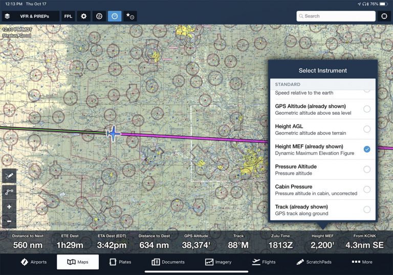
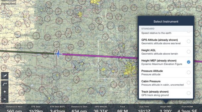
Dynamic Max Elevation Figure
The instrument panel at the bottom of the moving maps screen can display a variety of user-selected data like GPS groundspeed, ETA to destination, ground track and much more. Tap any of the fields to display a list of options, and you’ll likely see an option that you’ve skipped over many times called “Height MEF”, which stands for Dynamic Maximum Elevation Feature. This will display the tallest obstacle or terrain within a 1/2 degree latitude by 1/2 degree longitude centered around your aircraft’s location when moving at 40 kts. or greater, rounded up to the nearest 200 feet. To provide some perspective, that’s approximately a 25 square mile region around your current position when flying in the midwest. Consider enabling this field at all times for quick reference in the event an emergency requires a rapid descent near unfamiliar terrain.
Select Runway
Whether flying VFR or IFR, make it a habit to accomplish this next tip and specify the landing runway in ForeFlight. This can be accomplished in several different ways, including tapping the destination airport from the route editor or tapping the airport location right on the map, and choose “select runway”. After selecting the landing runway, an extended blue line will appear for the runway’s final approach path to help set up for the final approach and provide visual confirmation that you’re indeed lined up with the correct runway. You can also use this when departing an airport, to highlight the selected runway on ForeFlight’s aeronautical map depiction of the airport.
The post Six ForeFlight Tips to Use on Your Next Flight appeared first on iPad Pilot News.
Source: Ipad appsSix ForeFlight Tips to Use on Your Next Flight


