That all changed last July when I had the opportunity in a few short weeks to cross the Great Smokies and the Northern Rockies en route to Fairbanks in a Cessna 172.
A popular way to prepare for mountain flying is taking a flying course, usually in one of the western states such as Colorado, Wyoming, Utah or Montana. But such a course was not an option for me.
However I was able to put in a good bit of study, some practice flying and engage in plenty of conversation with knowledgeable flyers. All that helped me head into the mountains with a good understanding of what I would face.

Chuck Jarecki
“In the mountains the weather changes quick,” said Chuck Jarecki, veteran Montana pilot and a founding director of the Recreational Aviation Foundation. “My dad was a professional pilot and he told me get on the telephone and call somewhere where you’re going and just ask them about the weather.”
 On the way to Alaska we tried to use all resources available. In Morganton, N.C., for instance, before the flight across the Great Smokies, my co-pilot and I talked with a briefer on multiple occasions before launching. He let us know that the good weather on the first leg from Marion, S.C., was disintegrating across the mountains.
We checked locations en route for ceilings and forecasts and kept a constant eye on weather information in the cockpit thanks to our Stratus 2 receiver (pictured left).
We also utilized the time-honored method of taking an airborne look-see at the marginal weather along the foothills of the Smokies before deciding it was safe to proceed.
The best decision in the mountains is sometimes not to launch, according to Jarecki.
“Don’t be in a rush if you’re not comfortable,” he advises. “Don’t push yourself out of your comfort zone. If the weather doesn’t look good, stay on the ground. Call around. Don’t be afraid to ask the local people for advice. Most people are pretty good about talking to you.”
Survival Gear
Obviously you need to know exactly where you are in the mountains, but others should know as well, Jarecki said.
 “I carry a personal locator beacon,” he said. “I always have it in my pocket.”
That was the same advice offered by Alaska bush pilot Will Johnson, who said his InReach Explorer satellite communicator is an essential part of his survival kit.
Johnson made a forced landing in the Alaska wilderness in August 2013 but was able to message rescuers with his communicator, a device that was transmitting his location. He also carried a satellite phone that he used to confirm the situation and his intention to walk out.

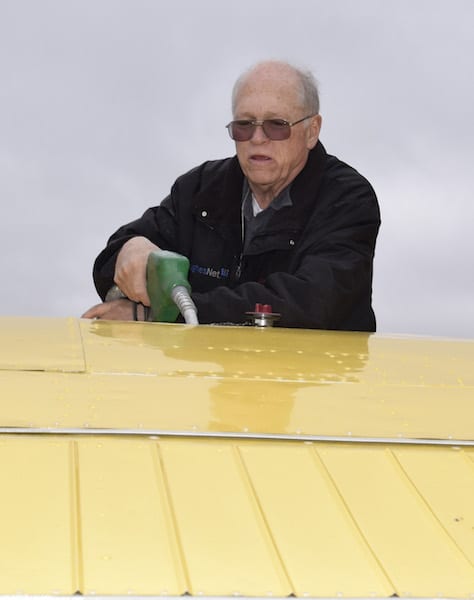
Alaska bush pilot Will Johnson fuels his aircraft.
On the Alaska flight I also carried an InReach Explorer.
Jarecki, who has flown almost everywhere between Nome and Panama and to the northern tip of Labrador over the past half century, said, “You can be in a situation in the mountains where the only thing you have will be what’s fastened to your body. I usually wear a jacket with a bunch of survival items in it. For the big trips I also rent a satellite phone to go with the locator beacon.”
“Another thing I practice is slowing the airplane down when things get a little nasty in a mountain valley,” he continued. “You can then make a U turn easily and retreat to better conditions.”
Another Montana aviator, retired U.S. Air Force pilot Joe Kuberka, taught a mountain flying course to Air Force Academy instructor pilots. He now teaches mountain flying at his Blue Goose Aviation School in Polson, Mont. and is a Montana Mountain Search and Rescue Pilot.
“There is no marginal VFR in the mountains,” he noted. “You are either IFR or VFR. There are a lot of areas where there is no weather information in between. Don’t push your weather too much.”

Kuberka regularly gives talks on backcountry flying, including at last year’s SUN ‘n FUN.
Kuberka carries a backpack survival kit for every flight. As he noted during a SUN ‘n FUN seminar last year, he advises using aviation and highway webcams whenever possible to preview the route of flight and difficult passages.
Kuberka, who will guide pilots on an Alaska Highway flying trip this summer, added, “If you’re going to be doing Alaska mountain flying, go to Aviation Webcams Alaska. Start looking at the webcams well before your trip. Ask yourself, if I saw what I saw today, would I go or would I not?”
Watch the Weather
On many mountain routes, there is often a choke point for bad weather. This can be a particular pass or valley. On the Alaska Highway, veteran pilots warned about the Rancheria Valley between Watson Lake and Whitehorse in the Yukon.
Gerd Mannsperger, a German-born air charter operator for Alpine Aviation in Whitehorse, cautioned, “The weather tends to get backed up around Rancheria and the clouds come down. Be careful going through there.”
That’s the sort of local knowledge, obtained by asking, that Jarecki talked about.
 In mountain flying discussions the late Sparky Imeson’s name comes up a lot. Before taking off for Alaska I read Imeson’s book, “Mountain Flying Bible” and Fletcher Anderson’s “Flying The Mountains.” Both were helpful when we encountered rough air and stormy weather in the Northern Rockies.
Handling turbulence and wind will be a large part of your mountain flying education and after only a few hours in the mountains I don’t pretend to be an expert. I do know that weather briefers and pilot reports help prepare you for what’s up ahead.
On the flight to Alaska we were warned about turbulence on the day we entered the Northern Rocky Mountains. Right on schedule we were banged around by light turbulence entering the first pass at Steamboat out of Fort Nelson, B.C.
Pilots routinely experiment with various altitudes trying to find the sweet spot where there is smoother air. Others recommend following the Sparky Imeson rule.
In Mountain Flying Bible, he wrote, “Fly an altitude equal to one-half of the distance from ground level (not MSL) to mountaintop level. Flying at this altitude does not and cannot guarantee the absence of turbulence, but it does provide a guarantee that you would avoid all destructive rotor turbulence.”
In Montana, between Cut Bank and Miles City, we experienced both up and downdrafts. In both cases we did not seek to hold a constant altitude but tried to ride it out. On strong downdrafts I resisted the almost overwhelming instinct to pull back on the yoke, risking an airframe overstress.
The advice from experienced pilot friends echoed what Imeson wrote in his book: “The reason for lowering the nose when a downdraft is encountered is to increase the airspeed and get out of the downdraft faster than if the best rate-of-climb or best angle-of-climb speed is used. It is true that by lowering the nose the vertical speed will increase. But when a slower speed is used, the plane is exposed to the downdraft for a greater period of time and loses more altitude overall.”
Thunderstorms
Thunderstorms and aircraft don’t mix well at any time. But in the flatlands, you can often find a way around. In the mountains your options are usually limited by the sides of the valley you’re flying.
And we confirmed one of Imeson’s warnings about the appearance of such storms: “The visual aspects of the cumulonimbus cloud with radar or stormscope-type equipment often provides surprises. Sometimes the most benign or the most innocent appearing storms will hold surprises.”
In our case, we were forced to fly under the extreme edge of a dark cloud mass, the center of which was probably 15 miles away, a distant mass that had a developing cumulonimbus anvil at the 40,000 foot level. That innocent looking shadow of a cloud tip over our aircraft suddenly spit out rain and blew us 500 feet up and 400 down again in seconds.
The passes along the Alaska Highway differ from many of the higher mountains passes in the Lower 48 in that there is a road surface to track through them along the Highway and the passes are all relatively low. The highest is Summit Pass between Watson Lake and Fort Nelson at 4,200 feet.
No matter the elevation, it’s mandatory to see the other side of the pass before going in. A bad situation can get worse quickly if you head up to the pass and then make a decision to go through hoping for clearing weather.
“For the pilot not experienced in mountain flying, be cautious,” advises another experienced pilot, Dan Lilja of Plains, Mont. “It’s always better to be safe than sorry — especially if the weather is going to deteriorate. Thunderstorms can stop everything.”

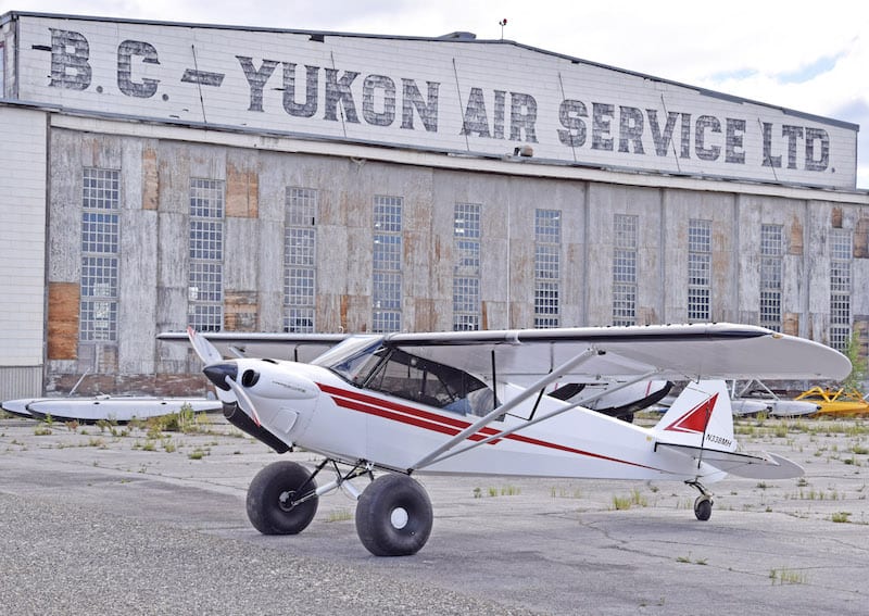
Dan Lilja’s Carbon Cub EX next to a World War II era hangar at Watson Lake in the Yukon territory. (Photo by Bill Walker)
Lilja, whose flying his been predominantly in Montana and the mountain states of the West since earning a pilot’s license in the 1970s, added, “Pilots should be aware of wind direction and wind velocity and how that relates to the mountain range that you are flying. Most mountain ranges are generally lying north and south and often times the strong winds come from the west. So if you’re on the windward side, it can be smooth. But on the lee side it can be rough. Sometimes you just have to land and wait for another day.”
Tips
My suggestions for first time pilots taking on mountainous terrain are:
- Know your aircraft and its capabilities and don’t exceed the aircraft’s limits or your own as a pilot.
- Study the weather and expect it to change quickly, often for the worse.
- Take a mountain flying course, plus do your reading and talk to experienced pilots.
One final thing — no one is exempt from the dangers of mountain flying. Sparky Imeson, regarded as one of the most skilled mountain flyers in Montana history, was killed March 18, 2009, while on a flight in a Cessna 180 over rugged terrain from Bozeman, Mont., to Helena.
The National Transportation Safety Board final report said the evidence at the site was indicative of a high-speed controlled flight collision with trees and that there was no evidence of any failure or problem with the airframe or the engine prior to the crash.
Source: http://generalaviationnews.comLessons learned: Mountain flying