
ForeFlight has gained a loyal following in part by continuously adding features, so the ForeFlight of two years ago looks almost unrecognizable today. That’s great news for pilots, who get powerful new tools seemingly every month, but it does mean that some features occasionally get lost in the shuffle.
Here’s a look at five helpful features in ForeFlight that you may not be using.
1 – Nearest Weather.
The Airports page has a wealth of information, from frequencies to runway data to fuel prices, but most of it is organized around a specific airport (often your departure or destination). Sometimes, though, you just want to get a quick idea of nearby weather conditions. While you could go to the Maps page and tap on a bunch of METAR symbols, this takes time.
A quicker and simpler option is to tap the crosshair button at the top right corner of the Airports page. This will show all the airports closest to your current position that report weather. At a glance you can see the wind, ceiling and visibility in your immediate area. Is that fog only at the one airport in the river valley or is it widespread? With one tap you can find out.

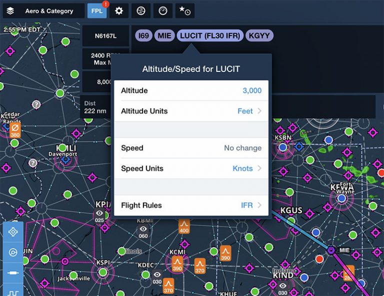
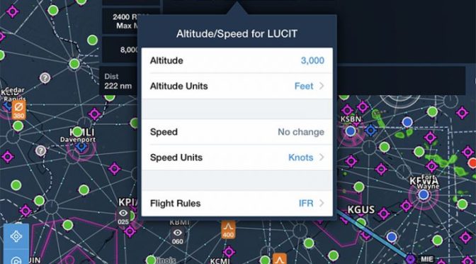
2 – Set speed/altitude at a waypoint.
Entering a cruising altitude in the FPL box in ForeFlight is essential for proper route planning – the app will calculate a highly accurate time en route and fuel burn total based on winds aloft forecasts. But what If you’re flying a flight with legs at multiple altitudes? For example, maybe you need to fly 30 miles below a Class B shelf before climbing up to cruise altitude.
Fortunately, ForeFlight has a handy feature that allows you to specify a speed or altitude at specific waypoints. From the Maps page, enter a route in the FPL box, then tap on a waypoint. A drop-down menu will show a variety of options, including set speed/altitude. Tap that option to set a specific altitude and/or speed. In the example below, we are planning to cross the LUCIT intersection at 3000 feet, IFR. Note that this won’t update your time en route calculations, but it’s a handy reminder if you’re creating your own route and it’s also useful for European pilots who may have to frequently change altitudes on cross-country flights.

3 – Content Packs.
Last year ForeFlight introduced Content Packs for all Plus subscribers, a way to import custom data and display it in the app. This includes map layers, waypoints, and documents, and is useful for all kinds of pilots. The easiest way to use Content Packs is to download a sample ForeFlight pack and modify it, but it’s also fairly straightforward to create your own .zip file and email it to your iPad. Then you can open it in ForeFlight and add it to the Custom Content page under the More tab.
In the example below, we’ve created a custom map layer for the practice area at Sporty’s Academy (our flight school), so student pilots can stay aware of the boundaries. Once the Content Pack was imported, we simply went to the Maps page, tapped the layers menu and selected the custom layer at the bottom.

4 – FBO directions.
This is a simple problem, but one that is easily solved by ForeFlight: you’ve finished your lunch or meeting and it’s time to head back to the airport, but you don’t know how to get there. Simply open ForeFlight, go to the Airports page and tap on the FBO button. The pop-up window shows options for calling them (phone symbol), emailing them (letter symbol), or getting directions (arrow symbol). Just tap the arrow and the address will open up in the Maps app on your device. Tap Directions to start navigation. It’s a fast and reliable way to get turn-by-turn directions.

5 – Takeoff and landing performance.
This requires a Performance Plus subscription, but it’s a surprisingly helpful tool. Sure, jet pilots are very concerned about runway performance, but plenty of Cirrus and Mooney pilots should be too – especially in summer. Instead of guessing whether that 3100 foot runway is long enough, ForeFlight makes it incredibly easy to calculate the exact numbers, including runway slope, wind direction, and airplane weight.
From the Flights page, create a flight then tap the Takeoff button next to your departure airport or the Landing button next to your destination airport. That will bring up a new page with runway and weather information pre-filled. You can adjust all the values to play around with different scenarios, and get a very precise takeoff/landing distance, plus Vref (approach speed) and climb performance. Like weight and balance, there’s no excuse for failing to run the numbers every time.

For more ForeFlight tips, check out Sporty’s Flying with ForeFlight Course.
The post Five overlooked ForeFlight features appeared first on iPad Pilot News.
Source: Ipad appsFive overlooked ForeFlight features