
One of the promises of ADS-B datalink weather (technically called FIS-B) was that it would improve over time, with new weather products and better performance coming out free of charge. In spite of some pilots’ skepticism about an FAA-sponsored program, that promise has largely been fulfilled. Last fall, the FAA added lightning, cloud tops, Center Weather Advisories, and turbulence forecast maps to the weather feed.
Over the last month, tens of thousands of pilots flying with subscription-free ADS-B weather have seen even more new products appear. These don’t require any new hardware, just an update to the latest version of ForeFlight.
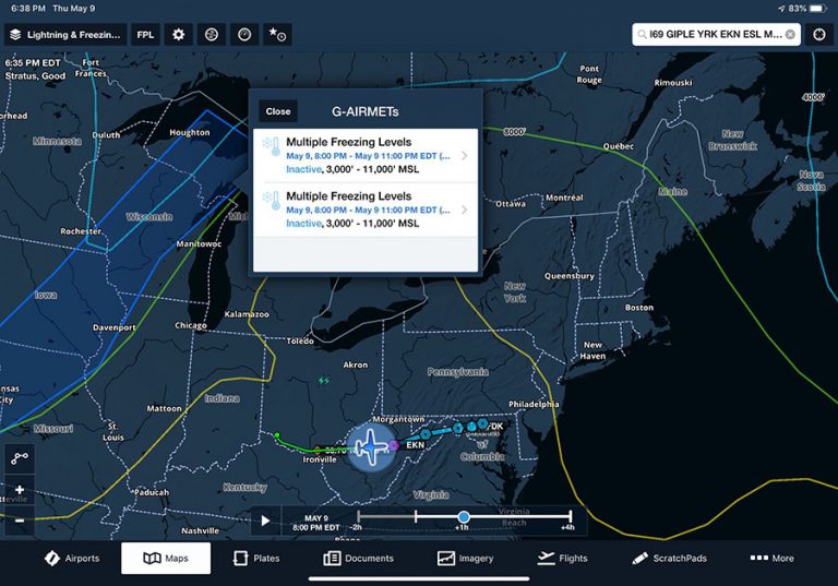
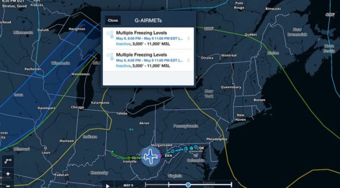
First up is the freezing level graphic, which is part of the new G-AIRMET product that’s being delivered over FIS-B. This shows up as a layer on ForeFlight’s Maps page, and is the familiar isotherm depiction. Freezing level charts are helpful for finding a potentially ice-free cruising altitude.

The most important weather product for most pilots is radar, and that’s also new. The picture and the overall functionality is really the same, but it’s now being sourced from the Multi-Radar/Multi-System radar (MRMS) product. The National Severe Storms Laboratory describes MRMS as “a system with automated algorithms that quickly and intelligently integrate data streams from multiple radars, surface and upper air observations, lightning detection systems, and satellite and forecast models.” The goal is a more accurate radar image. You can learn more at their website.
One other potentially nice upgrade with MRMS is faster update rates. As reported by Scott Dennstaedt, “it’s likely the age of the MRMS radar mosaic you now see in the cockpit will be newer than the legacy radar product it used to broadcast.” In our initial testing this seems to be the case, with timestamps about 2-4 minutes old. As always, datalink radar remains a big picture tool, not a way to pick through storms, but fresher data is always better.
Remember, there’s nothing you need to do as a pilot. Just turn on your Stratus or Sentry and select the radar layer.

One weather product was promised last year but still isn’t quite ready for primetime: icing forecast layers. This is a forecast, so less useful for real-time decision-making than radar or METARs, but it’s a very accurate product that would be nice to have. While the FAA announced its availability, you won’t find it in most apps right now. We talked to Jason Miller at ForeFlight, who said there are some issues with the FIS-B data feed: “we decided it’s more confusing and misleading than helpful. It’s a known issue in the feed and will hopefully be resolved this year.”
Neither of these changes represents a fundamental shift in the world of ADS-B; more than anything, all the action with FIS-B weather products is a vote of confidence in the system. With faster updates and new weather tools, pilots can make smarter in-flight decisions.
The post ADS-B weather adds new product, faster radar updates appeared first on iPad Pilot News.
Source: Ipad appsADS-B weather adds new product, faster radar updates